Loading…
Travel to Turkmenistan
Turkmenistan · Sayoda Travel



Kopetdag is a mountain range stretching along the southern border of Turkmenistan, between Ashgabat and Iran. These mountains are not only a natural boundary but also play a crucial role in shaping the region’s climate and water resources. The height of Kopetdag reaches approximately 2,940 meters at the peak of Mount Kunya-Uran, offering picturesque views of the plains, valleys, and the city of Ashgabat. Kopetdag is rich in diverse flora and fauna, including species unique to this region. The mountain slopes are covered with forests, shrubs, and steppe vegetation, and numerous springs and streams feed rivers and replenish underground water sources. The mountains are also significant for tourism. Hiking and mountaineering enthusiasts can find a range of routes here, from easy valley walks to challenging climbs up steep slopes. In winter, some areas of Kopetdag receive snow, creating a striking contrast with the hot desert lowlands. Kopetdag also preserves traces of history and culture. Archaeological sites, ancient settlements, and fortresses in the region tell the story of human life here over millennia. Kopetdag is not only a natural wonder but also a place where history, culture, and nature intersect, creating a unique landscape that attracts tourists, researchers, and lovers of active recreation.
Learn more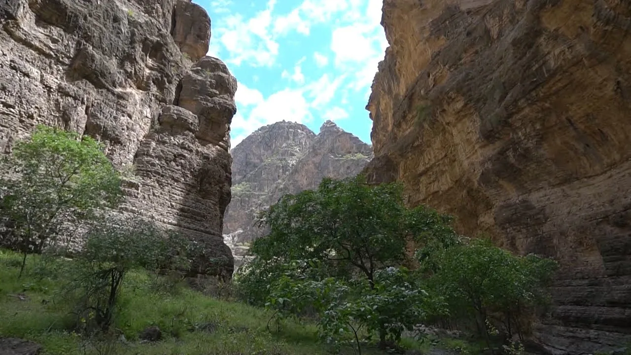
Running along the eastern edge of Turkmenistan is the south-western ridge of the Gissar Range of the Pamir-Alay mountain system, named Kugitang since the dawn of time. Another name, Koytendag, means “impassable mountains”. The western slopes of the Range are truly impassable. They are jagged with numerous gorges reminiscent of canyons with several-hundred-meter-high precipices. The region is one of the richest in Turkmenistan in natural and mineral resources. It boasts large deposits of rock and potassium salt, native sulfur, gypsum, celestine, polymetals, barites, marble onyx, cladding stones, and other building materials. Turkmenistan’s highest peak, Ayrybaba, is in the Koytendag. It is the area of strikingly beautiful natural scenery, especially in the winter, when the summit and access routes are covered in snow, which can be several meters deep in some places. The Zeravshan juniper is the only plant to survive in this snow-clad terrain. Yet, even this mighty and usually tall, branchy tree takes an unusual trailing form, withstanding strong winds. In spring, the flower-strewn area is ablaze with color. In February, bright crocuses bloom in thawed patches almost at the summit. Markhors, argalis, and lynx – animals listed in the Red Data Book of Turkmenistan – are found in juniper forests on the mountain slopes. The Koytendag is home to a wealth of wildlife with a total of 1,170 species, of which about 1,000 are plant species. The Koytendag State Nature Reserve helps to protect natural landmarks: the Umbardere Gorge, Kyrkgyz Gorge, Daraydere Canyon, the Unabi tree (jujube) grove, thermal springs near the foothills of Gaynarbaba, the centuries-old plane trees in the village of Koyten, the age-old mulberry tree in the Khojagaravul Gorge, the Karlyuk Karst Caves, and the Dinosaur Plateau.
Learn more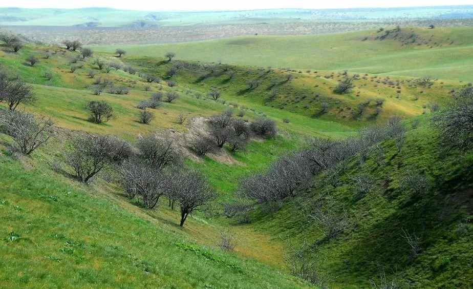
Badhyz Nature Reserve (Turkm. Bathyz goraghanasy ) is located in Mary province in southern Turkmenistan. Covering an area of 877 square kilometers, it was established in 1941 to protect the ecosystems of the Badhyz plateau between the Kuschka and Tejen rivers. The reserve is a semi-desert region with hills and plains, distinguished by unique flora and fauna characteristic of this part of Central Asia. The administration of the reserve also manages three sanctuaries: Kyzyljar, Pulihatum, and Chemenabit, all established in 1956. Badhyz Reserve has attracted the attention of scientists since its inception. Botanists, zoologists, and geographers have studied the nature here, while efforts have been made to protect kulan and goitered gazelles. The terrain of the reserve is varied: hills range from 20 to 200 meters in height, gradually rising in the southwest to 800 meters, forming a mountainous landscape. One of the most remarkable areas is the Erolanduz basin, a 20-kilometer-long depression with a saline lake up to 500 meters deep. The edges of the basin are surrounded by black volcanic and rocky outcrops, and traces of ancient plants can be found on andesite-basalt layers. Water resources in Badhyz Reserve are scarce. The main sources of water for animals are the Kuschka and Tejen rivers, the freshwater springs Akarshem and Nerdevanly, and temporary pools. The reserve plays a crucial role in protecting rare species, such as kulan and goitered gazelles, and preserving the unique natural landscapes of southern Turkmenistan.
Learn more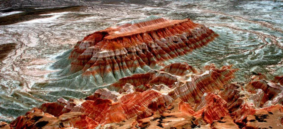
Yangikala Canyon is one of the most unique places in Turkmenistan, attracting travelers from across the country and abroad. The canyon is located in the Balkan region and is popular among tourists, extreme sports enthusiasts, and jeep tour adventurers. It has also become a trendy spot for wedding photo shoots and video clips. Overall, the site offers a perfect combination of excitement, adrenaline, and memorable photographs. The name “Yangikala” translates from Turkmen as “Fire Fortresses.” Locals also call these mountain ranges Kyzyldag, meaning “Red Mountains.” Indeed, the picturesque ridge, formed of white, yellow, red, and orange layers and carved by rain and wind, resembles fantastical castles and watchtowers of ancient fortresses. Millions of years ago, these mountains were the seabed. Today, the flat floor of the canyon, stretching for hundreds of kilometers, provides excellent opportunities for jeep safaris or long hikes, allowing visitors to admire this natural park of stone monuments. Travelers recommend climbing to the peaks of the mountain plateau to view the steep gorges from above, and if lucky, to find fossilized shells and stones of mysterious shapes and colors. Yangikala Canyon is especially breathtaking at sunset, when the surrounding landscape glows with fiery hues, creating a truly magical sight.
Learn more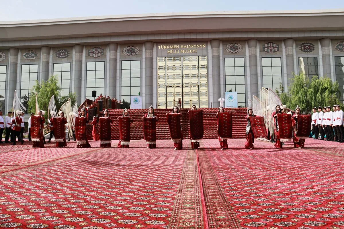
Turkmen carpet weaving has its roots in ancient times. According to scholars, the first carpets were woven over 2,500 years ago. Over the centuries, carpets reached the level of true art, with patterns that vary widely. They bear names such as “Tekke göl,” “Gabsa göl,” “Dyrnak göl,” “Saryk göl,” among others. The National Museum of Turkmen Carpets is one of the rare institutions worldwide where this remarkable art, steeped in centuries of tradition, is studied scientifically. The museum preserves carpet works from different periods, including large-scale pieces. Notable examples include “Heart of Turkmenistan” (1941), “Galkynysh” (2001), “Golden Age” (2009), as well as “President,” “Golden Star,” and others. These wool carpets, which maintain their beauty over centuries, impress with harmonious colors, sheen, elegant patterns, density, and subtle details. In the Ahal region’s “Gökdepe” museum, rare small carpets such as “Ensi” and “Aýna göl” are preserved, considered unique in Turkmen carpet art. Several masterpieces of Turkmen carpets are also kept in renowned museums abroad. The Pazyryk Carpet can be seen at the Hermitage Museum in Saint Petersburg, and Turkmen carpets are displayed at the Metropolitan Museum of Art in New York. The beauty of Turkmen carpets is also depicted in works by foreign artists. On December 12, 2019, in Bogotá, Colombia, at the 14th session of the UNESCO Intergovernmental Committee for the Safeguarding of the Intangible Cultural Heritage, the committee unanimously approved the inscription of Turkmen carpet weaving on the Representative List of the Intangible Cultural Heritage of Humanity. This demonstrates that Turkmen carpet art is recognized and celebrated worldwide. The outstanding books of the Hero Arkadag, “Living Tales” and “The Beauty of the Sky” , serve as a valuable source for studying Turkmen carpet weaving, which has been refined over centuries. Today, the attention given to Turkmen carpets is a clear testament to the revival and international recognition of this ancient craft.
Learn more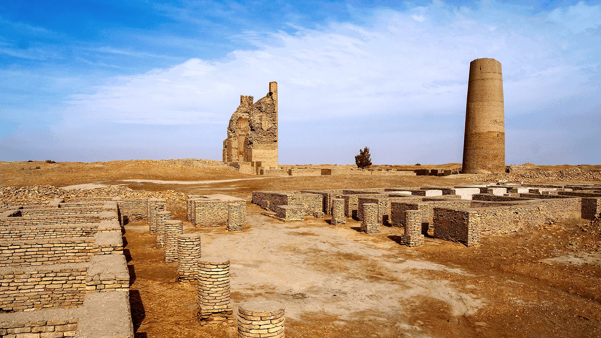
Dehistan is one of the most unique architectural monuments of medieval Turkmenistan. It is located among the sand dunes of the Etrek district, 25 kilometers north of the village of Madau and nearly 7 kilometers from the vast site of the ancient city of Misrian. Today, Dehistan is the crown jewel of the State Historical and Cultural Reserve “Ancient Dehistan,” established nearly 20 years ago. The monument is visible from afar: it was built on a strong platform, and its helmet-shaped dome rises prominently above the surrounding landscape. Among nearby medieval mausoleums, Dehistan stands out not only for its excellent preservation but also for its monumentality and perfection of form. In many books and travel guides, the site is also referred to as Shir-Kabir (the Great Sheikh). However, local elders recall that this name originally belonged to another structure in the northern outskirts of Dehistan, which was destroyed in the 1940s. It was a suburban mosque-nemazga, whose image survives only in old photographs; today, only a small hill and scattered bricks remain at that location. Dehistan has stood for over a thousand years at the center of an ancient necropolis, attracting the attention of architectural historians, art scholars, and pilgrims. The exquisite mihrab inside the building is particularly remarkable — a masterpiece of Islamic art from the 9th–10th centuries, unanimously recognized by specialists. Excavations at Dehistan have uncovered several mosques, caravanserais, and water supply systems including canals, irrigation ditches, and drainage networks. In 1998, relevant documents were submitted to UNESCO for the inclusion of Dehistan in the World Cultural Heritage List.
Learn more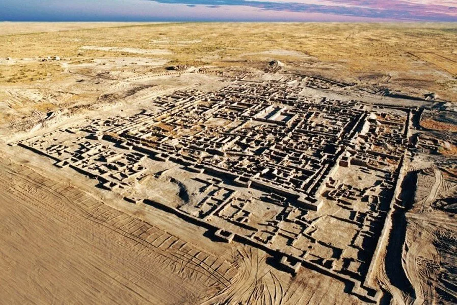
Gonur Depe is one of the most remarkable archaeological sites in Turkmenistan. It is located in the Karakum Desert, about 60 kilometers from the city of Mary. This ancient city, founded more than 4,000 years ago, is considered the capital of the ancient Margiana civilization and one of the key centers of the Bactria–Margiana Archaeological Complex (BMAC). The city was built around 2300 BC and covered an area of more than 50 hectares. At its center stood a fortified palace complex, surrounded by temples and residential quarters. Archaeological excavations led by Viktor Sarianidi uncovered unique finds here, including gold and silver jewelry, ritual objects, ceramics, and wall paintings that reveal the advanced culture and beliefs of the ancient Margians. Particularly notable are the temples of fire and water, which played a central role in the city’s religious life. Scholars believe that some of the traditions born here later influenced the development of Zoroastrianism. Today, Gonur Depe is an open-air archaeological site. Visiting it offers a rare opportunity to step back 4,000 years into history and witness the ruins of a city that once thrived in the heart of Margiana.
Learn more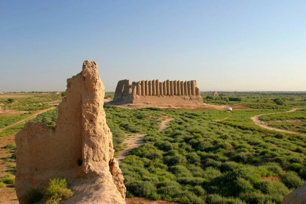
Merv is one of the oldest and most significant cities of Central Asia, located in modern-day Turkmenistan. Its history spans nearly four thousand years. For centuries, Merv was a vital center of the Great Silk Road, where trade and cultural routes of the East and the West converged. References to Merv appear in ancient Persian sources. At different times, the city served as the capital of the Achaemenids, Parthians, Sasanians, and Seljuks. In the 9th–12th centuries, Merv reached its peak, becoming one of the largest cities in the world. At that time, it earned the honorable title of “the mother of cities of the East.” Magnificent palaces and mosques rose within its walls, bustling workshops and bazaars thrived, and its libraries preserved invaluable treasures of knowledge. In the 13th century, the city was destroyed by the Mongols, yet its former greatness can still be felt among the ruins. Today, the archaeological site of “Old Merv” is included in the UNESCO World Heritage List . Visitors can see the remains of ancient fortresses, medieval walls and citadels, as well as the famous Mausoleum of Sultan Sanjar, a remarkable masterpiece of 12th-century Islamic architecture. A visit to Merv is a journey deep into the millennia. The atmosphere of the ruins transports you into the distant past, allowing you to feel the breath of history and touch the legacy of what was once one of the greatest cultural centers of Asia.
Learn more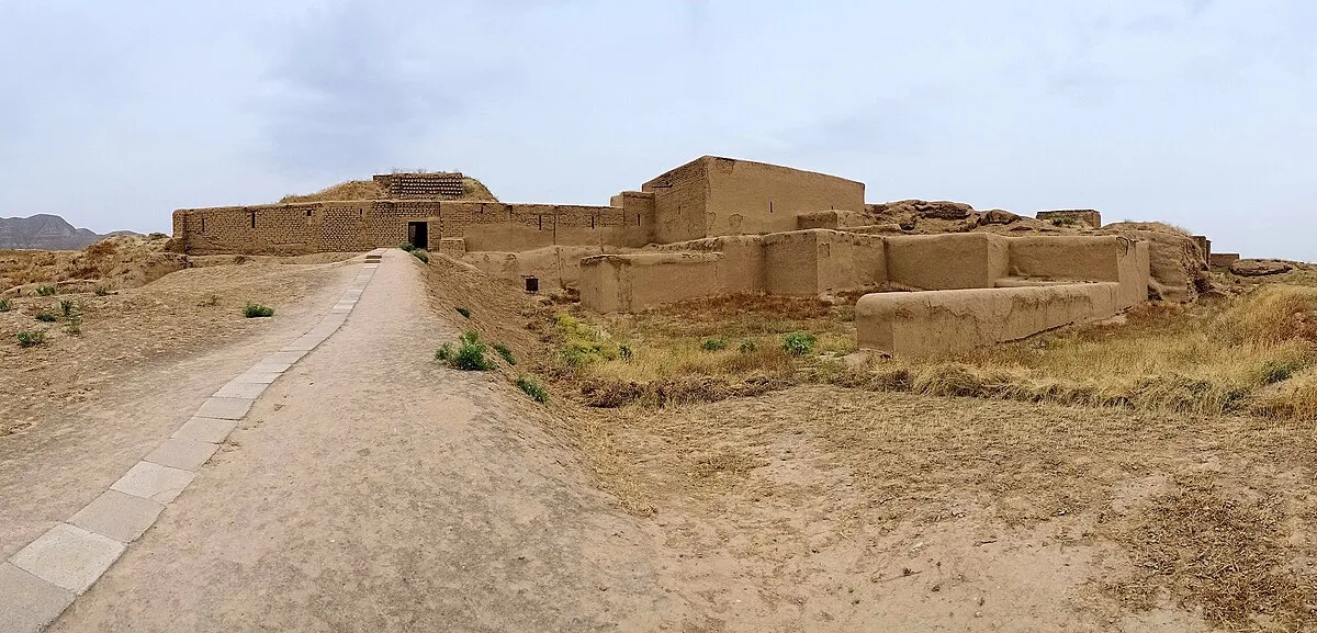
Nusay is one of the most important historical sites in Turkmenistan, located just a few kilometers from the capital, Ashgabat. This ancient fortress once served as the capital of the great Parthian Empire, which played a significant role in the history of both East and West. Today, Nusay is included in the UNESCO World Heritage List and is a must-visit site for history, culture, and archaeology enthusiasts. Today, Nusay is an archaeological complex divided into two parts: Old and New Nusaý. Old Nusay — ruins of the fortress with strong walls and towers. This is where the life of the ancient city once flourished. New Nusay — a complex with residential buildings and utility structures. The city was founded in the 3rd century BC during the Arsacid dynasty and became one of the first capitals of the Parthian Empire. It housed palaces, temples, a treasury, and even famous wine cellars. Archaeologists have discovered unique artifacts in Nusay, including clay vessels, marble statues, golden ornaments, and inscriptions, which help us understand how the Parthians lived more than two thousand years ago.
Learn more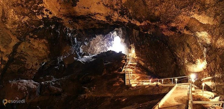
Kow-Ata (Kowata) is a natural underground lake located within the Kow-Ata Cave in Turkmenistan. It is renowned for its warm, mineral-rich waters, long believed to have therapeutic properties. The lake lies about 90 kilometers west of Ashgabat and is a popular destination for both locals and tourists. The water in Kow-Ata remains consistently warm throughout the year at around 35–37°C, allowing swimming even in winter. It is rich in minerals, especially sulfur, giving it a distinct odor and reputedly helping with certain skin and respiratory conditions. The Kow-Ata Cave itself is a unique natural attraction. To reach the lake, visitors must descend a steep staircase, plunging deep into the earth. The air becomes humid and saturated with mineral vapors, creating the distinct atmosphere of an underground world. Kow-Ata is not only a lake but also a serene retreat, helping to relieve stress and fatigue. Tourists describe swimming in the lake as an unusual experience: the water envelops the body, creating a sense of lightness and relaxation. Nearby, small resting areas allow visitors to change clothes and leave their belongings. Despite its popularity, the lake maintains a sense of seclusion, as it is situated in a mountainous area far from major settlements. Kow-Ata stands out for its natural beauty, subterranean mystery, and the therapeutic qualities of its mineral waters. It is an ideal destination for those seeking to combine recreation with wellness, as well as for anyone wishing to experience the underground world of Turkmenistan.
Learn more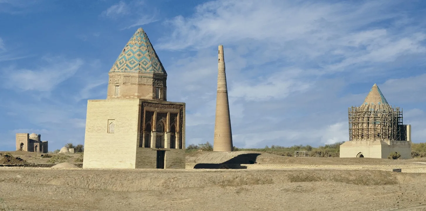
Konye-Urgench is one of the most unique historical sites of Turkmenistan, inscribed on the UNESCO World Heritage List. In the past, it was the capital of the Khorezm state and a major center of science, culture, and trade. Today, visitors can explore outstanding monuments of medieval architecture: Kutlug-Timur Minaret – the tallest minaret in Central Asia (62 meters). Mausoleums of Turkan Hatun and Il-Arslan – remarkable examples of Khorezmian architecture. Mausoleum of Najm al-Din al-Kubra – a sacred site for Muslims around the world. A walk through Köneürgenç is a journey into centuries of history, where the spirit of the ancient East is still alive.
Learn more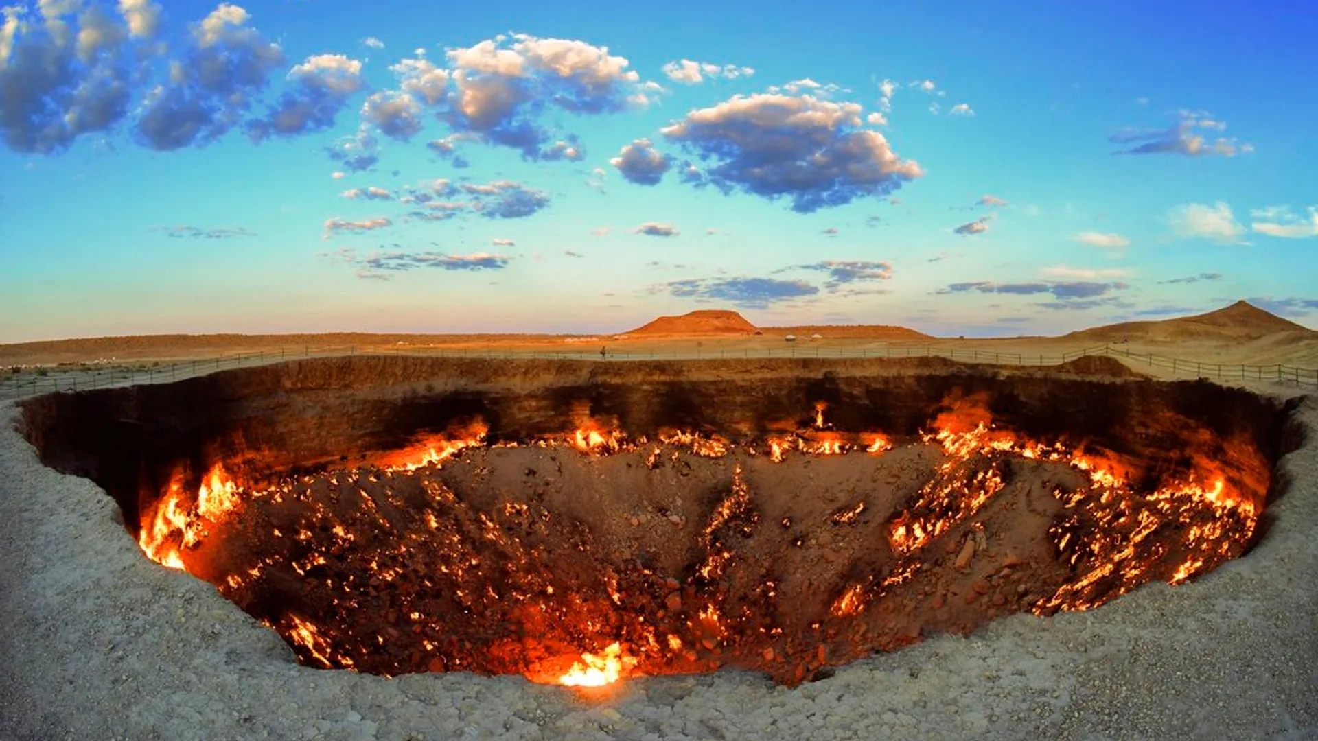
Darvaza is one of the most famous and mysterious places in Turkmenistan, known worldwide as the “Gates of Hell.” This unique natural phenomenon is located in the Karakum Desert, about 260 kilometers north of Ashgabat. The story of Darvaza began in 1971, when during geological exploration works, the ground beneath a drilling rig collapsed, revealing a cavern filled with natural gas. To prevent the release of poisonous methane, the geologists decided to set the gas on fire, expecting it to burn out within a few days. However, the flames have been burning ever since — for more than fifty years. Today, the Darvaza crater is an enormous fiery pit about 70 meters in diameter and around 20 meters deep. During the day, it looks like an unusual geological anomaly, but at night, the sight becomes especially breathtaking: the flames illuminate the desert, creating a mystical atmosphere. Darvaza has become a symbol of Turkmenistan and a must-see destination for travelers venturing into the Karakum. Visitors come to witness the “eternal flame of the desert,” feel the heat of the fire, and capture unforgettable photographs against the backdrop of the burning abyss. A trip to Darvaza is not only an encounter with a unique natural phenomenon but also a true adventure in the heart of the desert. Spending the night in a tent near the crater under the starry sky leaves unforgettable impressions and gives the sense of touching something mysterious and eternal.
Learn more