August 23, 2025Turkmenistan
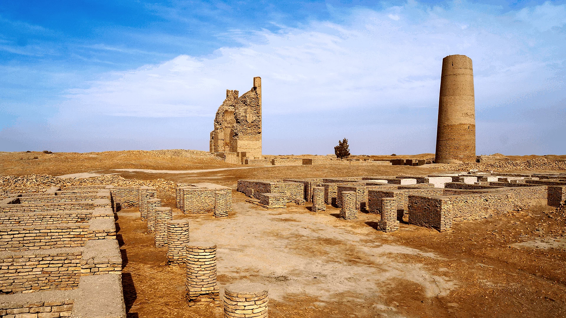
Dehistan is one of the most unique architectural monuments of medieval Turkmenistan. It is located among the sand dunes of the Etrek district, 25 kilometers north of the village of Madau and nearly 7 kilometers from the vast site of the ancient city of Misrian. Today, Dehistan is the crown jewel of the State Historical and Cultural Reserve “Ancient Dehistan,” established nearly 20 years ago.
The monument is visible from afar: it was built on a strong platform, and its helmet-shaped dome rises prominently above the surrounding landscape. Among nearby medieval mausoleums, Dehistan stands out not only for its excellent preservation but also for its monumentality and perfection of form. In many books and travel guides, the site is also referred to as Shir-Kabir (the Great Sheikh). However, local elders recall that this name originally belonged to another structure in the northern outskirts of Dehistan, which was destroyed in the 1940s. It was a suburban mosque-nemazga, whose image survives only in old photographs; today, only a small hill and scattered bricks remain at that location.
Dehistan has stood for over a thousand years at the center of an ancient necropolis, attracting the attention of architectural historians, art scholars, and pilgrims. The exquisite mihrab inside the building is particularly remarkable — a masterpiece of Islamic art from the 9th–10th centuries, unanimously recognized by specialists.
Excavations at Dehistan have uncovered several mosques, caravanserais, and water supply systems including canals, irrigation ditches, and drainage networks. In 1998, relevant documents were submitted to UNESCO for the inclusion of Dehistan in the World Cultural Heritage List.

Kopetdag is a mountain range stretching along the southern border of Turkmenistan, between Ashgabat and Iran. These mountains are not only a natural boundary but also play a crucial role in shaping the region’s climate and water resources. The height of Kopetdag reaches approximately 2,940 meters at the peak of Mount Kunya-Uran, offering picturesque views of the plains, valleys, and the city of Ashgabat. Kopetdag is rich in diverse flora and fauna, including species unique to this region. The mountain slopes are covered with forests, shrubs, and steppe vegetation, and numerous springs and streams feed rivers and replenish underground water sources. The mountains are also significant for tourism. Hiking and mountaineering enthusiasts can find a range of routes here, from easy valley walks to challenging climbs up steep slopes. In winter, some areas of Kopetdag receive snow, creating a striking contrast with the hot desert lowlands. Kopetdag also preserves traces of history and culture. Archaeological sites, ancient settlements, and fortresses in the region tell the story of human life here over millennia. Kopetdag is not only a natural wonder but also a place where history, culture, and nature intersect, creating a unique landscape that attracts tourists, researchers, and lovers of active recreation.
Learn more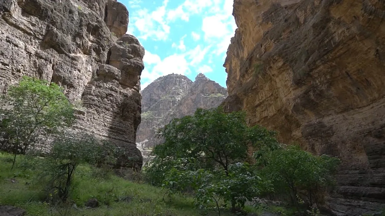
Running along the eastern edge of Turkmenistan is the south-western ridge of the Gissar Range of the Pamir-Alay mountain system, named Kugitang since the dawn of time. Another name, Koytendag, means “impassable mountains”. The western slopes of the Range are truly impassable. They are jagged with numerous gorges reminiscent of canyons with several-hundred-meter-high precipices. The region is one of the richest in Turkmenistan in natural and mineral resources. It boasts large deposits of rock and potassium salt, native sulfur, gypsum, celestine, polymetals, barites, marble onyx, cladding stones, and other building materials. Turkmenistan’s highest peak, Ayrybaba, is in the Koytendag. It is the area of strikingly beautiful natural scenery, especially in the winter, when the summit and access routes are covered in snow, which can be several meters deep in some places. The Zeravshan juniper is the only plant to survive in this snow-clad terrain. Yet, even this mighty and usually tall, branchy tree takes an unusual trailing form, withstanding strong winds. In spring, the flower-strewn area is ablaze with color. In February, bright crocuses bloom in thawed patches almost at the summit. Markhors, argalis, and lynx – animals listed in the Red Data Book of Turkmenistan – are found in juniper forests on the mountain slopes. The Koytendag is home to a wealth of wildlife with a total of 1,170 species, of which about 1,000 are plant species. The Koytendag State Nature Reserve helps to protect natural landmarks: the Umbardere Gorge, Kyrkgyz Gorge, Daraydere Canyon, the Unabi tree (jujube) grove, thermal springs near the foothills of Gaynarbaba, the centuries-old plane trees in the village of Koyten, the age-old mulberry tree in the Khojagaravul Gorge, the Karlyuk Karst Caves, and the Dinosaur Plateau.
Learn more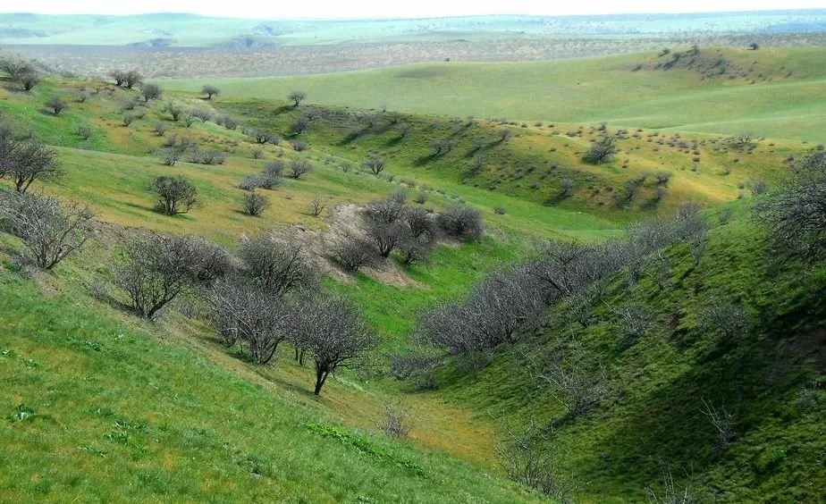
Badhyz Nature Reserve (Turkm. Bathyz goraghanasy ) is located in Mary province in southern Turkmenistan. Covering an area of 877 square kilometers, it was established in 1941 to protect the ecosystems of the Badhyz plateau between the Kuschka and Tejen rivers. The reserve is a semi-desert region with hills and plains, distinguished by unique flora and fauna characteristic of this part of Central Asia. The administration of the reserve also manages three sanctuaries: Kyzyljar, Pulihatum, and Chemenabit, all established in 1956. Badhyz Reserve has attracted the attention of scientists since its inception. Botanists, zoologists, and geographers have studied the nature here, while efforts have been made to protect kulan and goitered gazelles. The terrain of the reserve is varied: hills range from 20 to 200 meters in height, gradually rising in the southwest to 800 meters, forming a mountainous landscape. One of the most remarkable areas is the Erolanduz basin, a 20-kilometer-long depression with a saline lake up to 500 meters deep. The edges of the basin are surrounded by black volcanic and rocky outcrops, and traces of ancient plants can be found on andesite-basalt layers. Water resources in Badhyz Reserve are scarce. The main sources of water for animals are the Kuschka and Tejen rivers, the freshwater springs Akarshem and Nerdevanly, and temporary pools. The reserve plays a crucial role in protecting rare species, such as kulan and goitered gazelles, and preserving the unique natural landscapes of southern Turkmenistan.
Learn more